Biblioteca de design
Novos designs Merch
Camisetas
Vectores
Designs de Merch de Tendência
PNGs & SVGs
Mockups
Modelos de T-Shirt PSD
Explorar Desenhos
Designs KDP
Pôsteres
Canecas
Capas para celular
Sacos de compras
Almofadas
Ferramentas de desenho
Merch Designer
Novo!
Mockup Generator
Gerador de Design de AI
Vetorizador
Quote Generator
T-Shirt Maker (Antigo)
Ajuda
Merch Digest
Blog
Centro de Ajuda
Saiba mais sobre o Merch
Feedback
Soluções Corporativas
Empresa
Acesso à API
Estúdio de Design
Design em Lote
Preços
Carregando...
Inscrever-se
Conecte-se
PNG
geografia
Biblioteca de design
Novos designs Merch
Camisetas
Vectores
Designs de Merch de Tendência
PNGs & SVGs
Mockups
Modelos de T-Shirt PSD
Explorar Desenhos
Designs KDP
Pôsteres
Canecas
Capas para celular
Sacos de compras
Almofadas
Ferramentas de desenho
Merch Designer
Novo!
Mockup Generator
Gerador de Design de AI
Vetorizador
Quote Generator
T-Shirt Maker (Antigo)
Ajuda
Merch Digest
Blog
Centro de Ajuda
Saiba mais sobre o Merch
Feedback
Soluções Corporativas
Empresa
Acesso à API
Estúdio de Design
Design em Lote
PLANOS
PNG
geografia
682 Vetores editáveis em PNG e SVG de geografia
Baixar Vetores PNG e SVG editáveis de geografia com fundo transparente.
Relacionado:
entusiastas da geografia
,
geografia urbana
,
geografia asiatica
Ordenar por
Mais relevante
Resultados patrocinados da
Ganhe 15% de desconto com o código: VEXELS15
veja mais detalhes
Mandala dos Estados do Arkansas Desenho PNG
Escolha uma pasta
Todos os favoritos
Criar novo
Salvar
Mandala dos Estados do Arkansas Desenho PNG
Estados da mandala do Colorado Desenho PNG
Escolha uma pasta
Todos os favoritos
Criar novo
Salvar
Estados da mandala do Colorado Desenho PNG
Mandala dos Estados Delaware Desenho PNG
Escolha uma pasta
Todos os favoritos
Criar novo
Salvar
Mandala dos Estados Delaware Desenho PNG
Mandala dos Estados Geórgia Desenho PNG
Escolha uma pasta
Todos os favoritos
Criar novo
Salvar
Mandala dos Estados Geórgia Desenho PNG
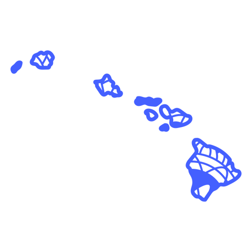
Mandala dos Estados do Havaí Desenho PNG
Escolha uma pasta
Todos os favoritos
Criar novo
Salvar
Mandala dos Estados do Havaí Desenho PNG
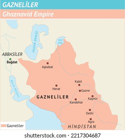
Mandala dos Estados Unidos Desenho PNG
Escolha uma pasta
Todos os favoritos
Criar novo
Salvar
Mandala dos Estados Unidos Desenho PNG
Mandala dos Estados Nebraska Desenho PNG
Escolha uma pasta
Todos os favoritos
Criar novo
Salvar
Mandala dos Estados Nebraska Desenho PNG
Mandala dos Estados Novo México Desenho PNG
Escolha uma pasta
Todos os favoritos
Criar novo
Salvar
Mandala dos Estados Novo México Desenho PNG
mandala dos estados oklahoma Desenho PNG
Escolha uma pasta
Todos os favoritos
Criar novo
Salvar
mandala dos estados oklahoma Desenho PNG
Mandala dos Estados Pensilvânia Desenho PNG
Escolha uma pasta
Todos os favoritos
Criar novo
Salvar
Mandala dos Estados Pensilvânia Desenho PNG
Mandala dos Estados Rhode Island Desenho PNG
Escolha uma pasta
Todos os favoritos
Criar novo
Salvar
Mandala dos Estados Rhode Island Desenho PNG
Estados da mandala da Dakota do Sul Desenho PNG
Escolha uma pasta
Todos os favoritos
Criar novo
Salvar
Estados da mandala da Dakota do Sul Desenho PNG
Estados da mandala do Tennessee Desenho PNG
Escolha uma pasta
Todos os favoritos
Criar novo
Salvar
Estados da mandala do Tennessee Desenho PNG
Premium
Silhueta do desenho do mapa da França Desenho PNG
Escolha uma pasta
Todos os favoritos
Criar novo
Salvar
Silhueta do desenho do mapa da França Desenho PNG
Premium
Silhueta elegante do design do mapa do Japão Desenho PNG
Escolha uma pasta
Todos os favoritos
Criar novo
Salvar
Silhueta elegante do design do mapa do Japão Desenho PNG
Premium
Mapa de silhueta estilizado da Suíça Desenho PNG
Escolha uma pasta
Todos os favoritos
Criar novo
Salvar
Mapa de silhueta estilizado da Suíça Desenho PNG
Premium
Silhueta estilizada do mapa da ilha de Hong Kong Desenho PNG
Escolha uma pasta
Todos os favoritos
Criar novo
Salvar
Silhueta estilizada do mapa da ilha de Hong Kong Desenho PNG
Premium
Esboço elegante do design do mapa de Taiwan Desenho PNG
Escolha uma pasta
Todos os favoritos
Criar novo
Salvar
Esboço elegante do design do mapa de Taiwan Desenho PNG
Premium
Mapa de contorno elegante do design do México Desenho PNG
Escolha uma pasta
Todos os favoritos
Criar novo
Salvar
Mapa de contorno elegante do design do México Desenho PNG
Mandala da silhueta do mapa de Hong Kong cortada Desenho PNG
Escolha uma pasta
Todos os favoritos
Criar novo
Salvar
Mandala da silhueta do mapa de Hong Kong cortada Desenho PNG
Mandala da silhueta do mapa da Irlanda cortada Desenho PNG
Escolha uma pasta
Todos os favoritos
Criar novo
Salvar
Mandala da silhueta do mapa da Irlanda cortada Desenho PNG
Mandala dos Estados Dakota do Norte Desenho PNG
Escolha uma pasta
Todos os favoritos
Criar novo
Salvar
Mandala dos Estados Dakota do Norte Desenho PNG
Ilustração da ferramenta Compass Desenho PNG
Escolha uma pasta
Todos os favoritos
Criar novo
Salvar
Ilustração da ferramenta Compass Desenho PNG
Ícone plano do mapa Desenho PNG
Escolha uma pasta
Todos os favoritos
Criar novo
Salvar
Ícone plano do mapa Desenho PNG
Premium
Mapa de silhueta do design da Irlanda Desenho PNG
Escolha uma pasta
Todos os favoritos
Criar novo
Salvar
Mapa de silhueta do design da Irlanda Desenho PNG
Premium
Silhueta estilizada do mapa de Gana Desenho PNG
Escolha uma pasta
Todos os favoritos
Criar novo
Salvar
Silhueta estilizada do mapa de Gana Desenho PNG
Premium
Silhueta preta estilizada do mapa de Cuba Desenho PNG
Escolha uma pasta
Todos os favoritos
Criar novo
Salvar
Silhueta preta estilizada do mapa de Cuba Desenho PNG
Premium
Silhueta minimalista do design do mapa da Bósnia e Herzegovina Desenho PNG
Escolha uma pasta
Todos os favoritos
Criar novo
Salvar
Silhueta minimalista do design do mapa da Bósnia e Herzegovina Desenho PNG
Premium
Silhueta ousada de um design de mapa de país Desenho PNG
Escolha uma pasta
Todos os favoritos
Criar novo
Salvar
Silhueta ousada de um design de mapa de país Desenho PNG
Premium
Mapa de silhueta estilizada de Camarões Desenho PNG
Escolha uma pasta
Todos os favoritos
Criar novo
Salvar
Mapa de silhueta estilizada de Camarões Desenho PNG
Premium
Design vibrante do mapa de Camarões com cores nacionais Desenho PNG
Escolha uma pasta
Todos os favoritos
Criar novo
Salvar
Design vibrante do mapa de Camarões com cores nacionais Desenho PNG
Premium
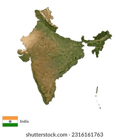
Silhueta estilizada do design do mapa da Índia Desenho PNG
Escolha uma pasta
Todos os favoritos
Criar novo
Salvar
Silhueta estilizada do design do mapa da Índia Desenho PNG
Inscreva-se
Para obter designs de uso comercial de alta qualidade para seus negócios
VER PLANOS
do 14
prev page
next page