Biblioteca de design
Novos designs Merch
Camisetas
Vectores
Designs de Merch de Tendência
PNGs & SVGs
Mockups
Modelos de T-Shirt PSD
Explorar Desenhos
Designs KDP
Pôsteres
Canecas
Capas para celular
Sacos de compras
Almofadas
Ferramentas de desenho
Merch Designer
Novo!
Mockup Generator
Gerador de Design de AI
Vetorizador
Quote Generator
T-Shirt Maker (Antigo)
Ajuda
Merch Digest
Blog
Centro de Ajuda
Saiba mais sobre o Merch
Feedback
Soluções Corporativas
Empresa
Acesso à API
Estúdio de Design
Design em Lote
Preços
Carregando...
Inscrever-se
Conecte-se
PNG
mapa
Biblioteca de design
Novos designs Merch
Camisetas
Vectores
Designs de Merch de Tendência
PNGs & SVGs
Mockups
Modelos de T-Shirt PSD
Explorar Desenhos
Designs KDP
Pôsteres
Canecas
Capas para celular
Sacos de compras
Almofadas
Ferramentas de desenho
Merch Designer
Novo!
Mockup Generator
Gerador de Design de AI
Vetorizador
Quote Generator
T-Shirt Maker (Antigo)
Ajuda
Merch Digest
Blog
Centro de Ajuda
Saiba mais sobre o Merch
Feedback
Soluções Corporativas
Empresa
Acesso à API
Estúdio de Design
Design em Lote
PLANOS
PNG
mapa
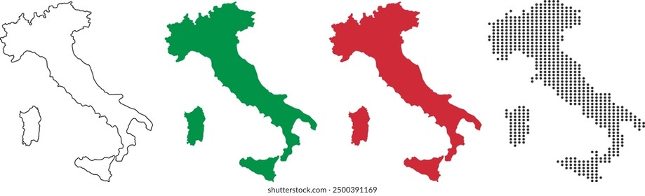
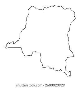
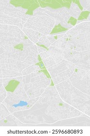
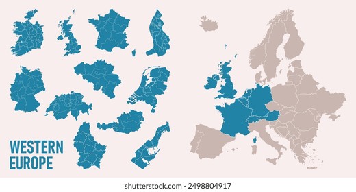
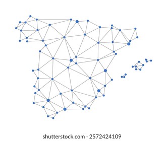
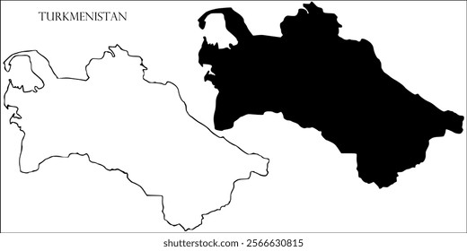
1325 Vetores editáveis em PNG e SVG de mapa
Baixar Vetores PNG e SVG editáveis de mapa com fundo transparente.
Relacionado:
mapa mundial
,
mapas
,
mapa global
Ordenar por
Mais relevante
Resultados patrocinados da
Ganhe 15% de desconto com o código: VEXELS15
veja mais detalhes
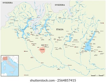
Mapa do Havaí poligonal Desenho PNG
Escolha uma pasta
Todos os favoritos
Criar novo
Salvar
Mapa do Havaí poligonal Desenho PNG
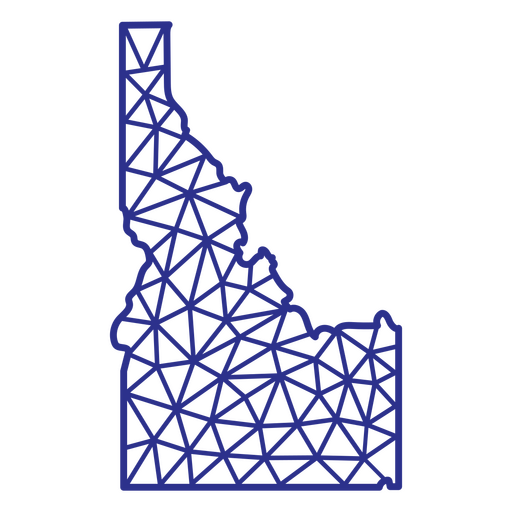
Poligonal do mapa de Idaho Desenho PNG
Escolha uma pasta
Todos os favoritos
Criar novo
Salvar
Poligonal do mapa de Idaho Desenho PNG
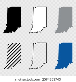
Poligonal do mapa de Indiana Desenho PNG
Escolha uma pasta
Todos os favoritos
Criar novo
Salvar
Poligonal do mapa de Indiana Desenho PNG
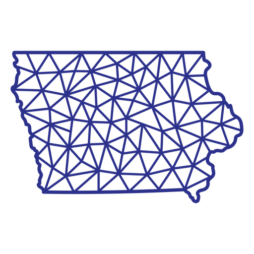
Mapa de Iowa poligonal Desenho PNG
Escolha uma pasta
Todos os favoritos
Criar novo
Salvar
Mapa de Iowa poligonal Desenho PNG
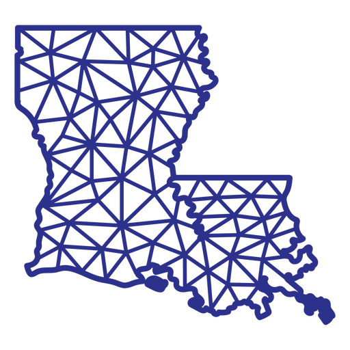
Louisiana mapa poligonal Desenho PNG
Escolha uma pasta
Todos os favoritos
Criar novo
Salvar
Louisiana mapa poligonal Desenho PNG
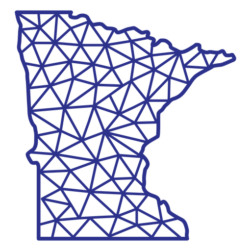
Poligonal do mapa de Minnesota Desenho PNG
Escolha uma pasta
Todos os favoritos
Criar novo
Salvar
Poligonal do mapa de Minnesota Desenho PNG
Mapa do Missouri poligonal Desenho PNG
Escolha uma pasta
Todos os favoritos
Criar novo
Salvar
Mapa do Missouri poligonal Desenho PNG
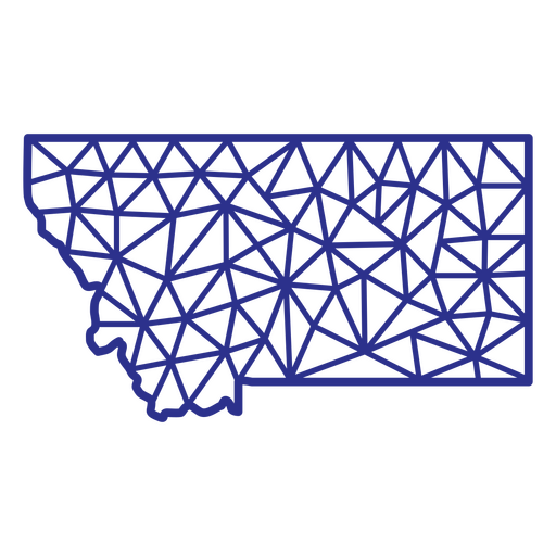
Poligonal do mapa de Montana Desenho PNG
Escolha uma pasta
Todos os favoritos
Criar novo
Salvar
Poligonal do mapa de Montana Desenho PNG
Mapa de Nebraska poligonal Desenho PNG
Escolha uma pasta
Todos os favoritos
Criar novo
Salvar
Mapa de Nebraska poligonal Desenho PNG
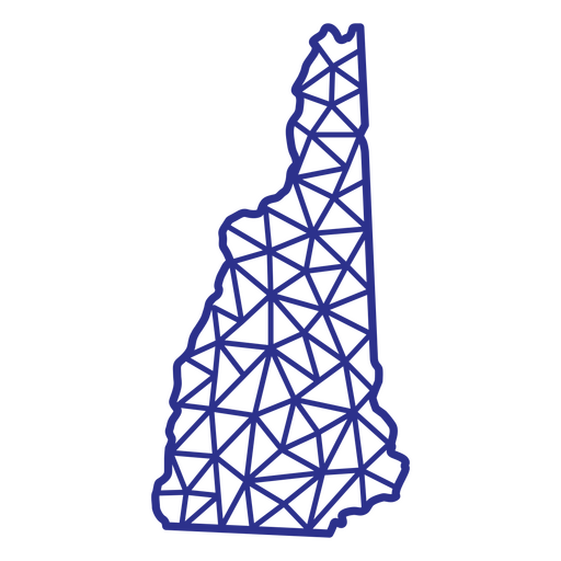
Mapa poligonal de New Hampshire Desenho PNG
Escolha uma pasta
Todos os favoritos
Criar novo
Salvar
Mapa poligonal de New Hampshire Desenho PNG
Poligonal do mapa de Nova York Desenho PNG
Escolha uma pasta
Todos os favoritos
Criar novo
Salvar
Poligonal do mapa de Nova York Desenho PNG
Poligonal do mapa de Oklahoma Desenho PNG
Escolha uma pasta
Todos os favoritos
Criar novo
Salvar
Poligonal do mapa de Oklahoma Desenho PNG
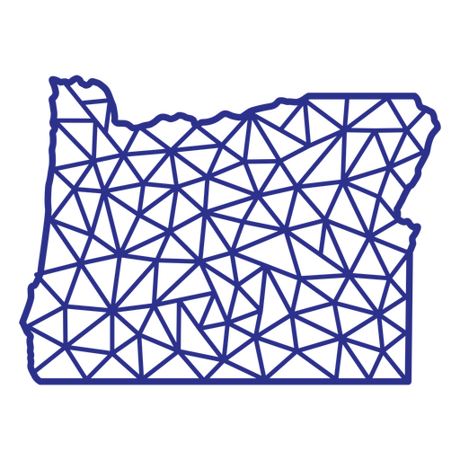
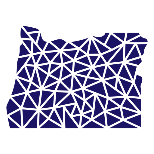
Poligonal do mapa de Oregon Desenho PNG
Escolha uma pasta
Todos os favoritos
Criar novo
Salvar
Poligonal do mapa de Oregon Desenho PNG
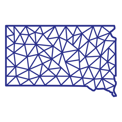
Mapa de Dakota do Sul poligonal Desenho PNG
Escolha uma pasta
Todos os favoritos
Criar novo
Salvar
Mapa de Dakota do Sul poligonal Desenho PNG
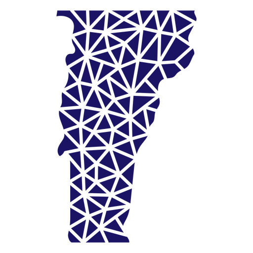
Vermont mapa poligonal Desenho PNG
Escolha uma pasta
Todos os favoritos
Criar novo
Salvar
Vermont mapa poligonal Desenho PNG
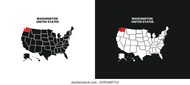
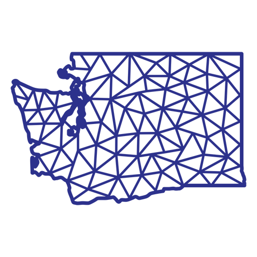
Washington mapa poligonal Desenho PNG
Escolha uma pasta
Todos os favoritos
Criar novo
Salvar
Washington mapa poligonal Desenho PNG
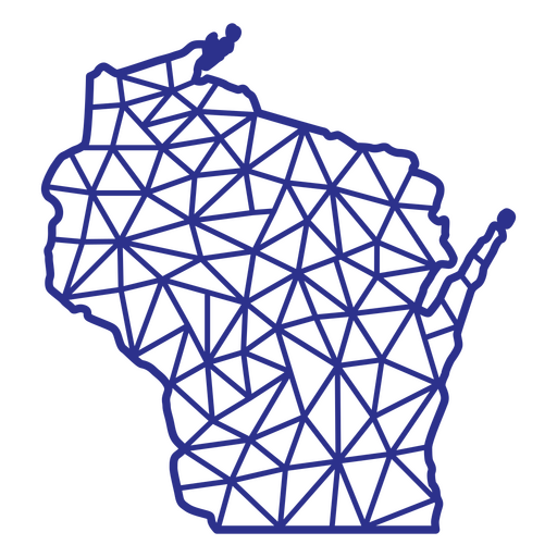
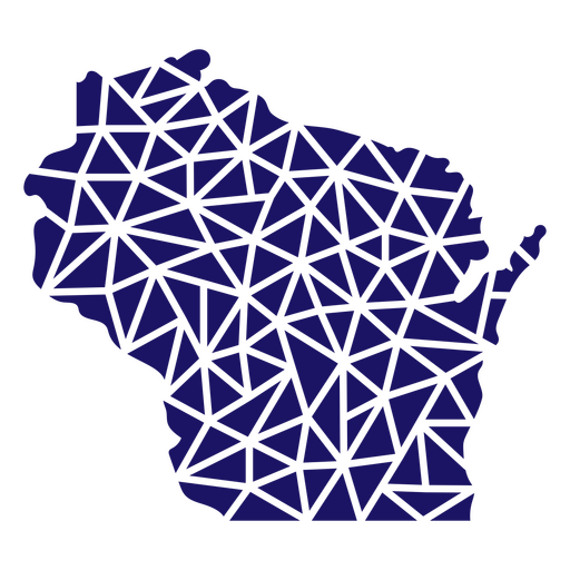
Mapa de Wisconsin poligonal Desenho PNG
Escolha uma pasta
Todos os favoritos
Criar novo
Salvar
Mapa de Wisconsin poligonal Desenho PNG
Mapa de Wyoming poligonal Desenho PNG
Escolha uma pasta
Todos os favoritos
Criar novo
Salvar
Mapa de Wyoming poligonal Desenho PNG
Poligonal do mapa dos EUA do Alasca Desenho PNG
Escolha uma pasta
Todos os favoritos
Criar novo
Salvar
Poligonal do mapa dos EUA do Alasca Desenho PNG
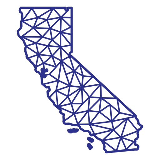
Poligonal do mapa da Califórnia Desenho PNG
Escolha uma pasta
Todos os favoritos
Criar novo
Salvar
Poligonal do mapa da Califórnia Desenho PNG
Mapa do Colorado poligonal Desenho PNG
Escolha uma pasta
Todos os favoritos
Criar novo
Salvar
Mapa do Colorado poligonal Desenho PNG
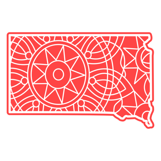
Mapa da Mandala de Dakota do Sul Desenho PNG
Escolha uma pasta
Todos os favoritos
Criar novo
Salvar
Mapa da Mandala de Dakota do Sul Desenho PNG
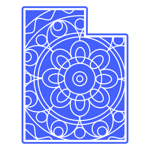
Mapa da Mandala de Utah Desenho PNG
Escolha uma pasta
Todos os favoritos
Criar novo
Salvar
Mapa da Mandala de Utah Desenho PNG
Mapa da Mandala de Vermont Desenho PNG
Escolha uma pasta
Todos os favoritos
Criar novo
Salvar
Mapa da Mandala de Vermont Desenho PNG
Mapa da Mandala da Virgínia Ocidental Desenho PNG
Escolha uma pasta
Todos os favoritos
Criar novo
Salvar
Mapa da Mandala da Virgínia Ocidental Desenho PNG
Mandala do mapa de Indiana Desenho PNG
Escolha uma pasta
Todos os favoritos
Criar novo
Salvar
Mandala do mapa de Indiana Desenho PNG
Mandala do mapa do Kansas Desenho PNG
Escolha uma pasta
Todos os favoritos
Criar novo
Salvar
Mandala do mapa do Kansas Desenho PNG
Mandala do mapa de Kentucky Desenho PNG
Escolha uma pasta
Todos os favoritos
Criar novo
Salvar
Mandala do mapa de Kentucky Desenho PNG
Mandala do mapa do Maine Desenho PNG
Escolha uma pasta
Todos os favoritos
Criar novo
Salvar
Mandala do mapa do Maine Desenho PNG
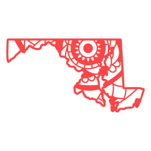
Mandala do mapa de Maryland Desenho PNG
Escolha uma pasta
Todos os favoritos
Criar novo
Salvar
Mandala do mapa de Maryland Desenho PNG
Mandala do mapa de Michigan Desenho PNG
Escolha uma pasta
Todos os favoritos
Criar novo
Salvar
Mandala do mapa de Michigan Desenho PNG
Mandala do mapa de Minnesota Desenho PNG
Escolha uma pasta
Todos os favoritos
Criar novo
Salvar
Mandala do mapa de Minnesota Desenho PNG
Mandala do mapa do Missouri Desenho PNG
Escolha uma pasta
Todos os favoritos
Criar novo
Salvar
Mandala do mapa do Missouri Desenho PNG
Mapa da Mandala de Wyoming Desenho PNG
Escolha uma pasta
Todos os favoritos
Criar novo
Salvar
Mapa da Mandala de Wyoming Desenho PNG
Mapa de traçado cheio de bandeira americana do estado de Massachusetts Desenho PNG
Escolha uma pasta
Todos os favoritos
Criar novo
Salvar
Mapa de traçado cheio de bandeira americana do estado de Massachusetts Desenho PNG
Mapa poligonal do estado de Oregon Desenho PNG
Escolha uma pasta
Todos os favoritos
Criar novo
Salvar
Mapa poligonal do estado de Oregon Desenho PNG
Mapa poligonal do estado de Wisconsin Desenho PNG
Escolha uma pasta
Todos os favoritos
Criar novo
Salvar
Mapa poligonal do estado de Wisconsin Desenho PNG
Mapa poligonal do estado de Montana Desenho PNG
Escolha uma pasta
Todos os favoritos
Criar novo
Salvar
Mapa poligonal do estado de Montana Desenho PNG
Mapa poligonal da Virgínia Ocidental Desenho PNG
Escolha uma pasta
Todos os favoritos
Criar novo
Salvar
Mapa poligonal da Virgínia Ocidental Desenho PNG
Mapa de traçado cheio de bandeira americana do estado de Iowa Desenho PNG
Escolha uma pasta
Todos os favoritos
Criar novo
Salvar
Mapa de traçado cheio de bandeira americana do estado de Iowa Desenho PNG
Silhueta do mapa do Mississipi eua Desenho PNG
Escolha uma pasta
Todos os favoritos
Criar novo
Salvar
Silhueta do mapa do Mississipi eua Desenho PNG
Mapa poligonal do estado de Vermont Desenho PNG
Escolha uma pasta
Todos os favoritos
Criar novo
Salvar
Mapa poligonal do estado de Vermont Desenho PNG
Mapa poligonal do estado da Virgínia Desenho PNG
Escolha uma pasta
Todos os favoritos
Criar novo
Salvar
Mapa poligonal do estado da Virgínia Desenho PNG
Mapa poligonal do estado de Nebraska Desenho PNG
Escolha uma pasta
Todos os favoritos
Criar novo
Salvar
Mapa poligonal do estado de Nebraska Desenho PNG
Mapa poligonal do estado do Tennessee Desenho PNG
Escolha uma pasta
Todos os favoritos
Criar novo
Salvar
Mapa poligonal do estado do Tennessee Desenho PNG
Mapa poligonal da Pensilvânia Desenho PNG
Escolha uma pasta
Todos os favoritos
Criar novo
Salvar
Mapa poligonal da Pensilvânia Desenho PNG
Mapa poligonal da Dakota do Sul Desenho PNG
Escolha uma pasta
Todos os favoritos
Criar novo
Salvar
Mapa poligonal da Dakota do Sul Desenho PNG
Mapa poligonal do Novo México Desenho PNG
Escolha uma pasta
Todos os favoritos
Criar novo
Salvar
Mapa poligonal do Novo México Desenho PNG
Mapa poligonal do estado do Kansas Desenho PNG
Escolha uma pasta
Todos os favoritos
Criar novo
Salvar
Mapa poligonal do estado do Kansas Desenho PNG
Traçado preenchido do mapa de Idaho Desenho PNG
Escolha uma pasta
Todos os favoritos
Criar novo
Salvar
Traçado preenchido do mapa de Idaho Desenho PNG
Inscreva-se
Para obter designs de uso comercial de alta qualidade para seus negócios
VER PLANOS
Próxima
do 27
prev page
next page