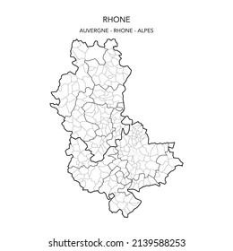
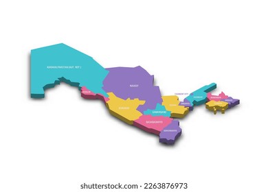
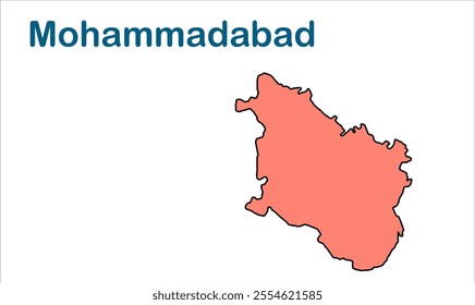
90 Gráficos e Designs de subdivision para Camisetas e Merch print on demand

Baixar designs de camisetas e para merch, como capas de livro, capas de celular, tote bags e mais de subdivision

Relacionado:

Ordenar por

Mais relevante
Political map of Argentina. Administrative divisions - provinces. Simple black outline vector map with labels.
Mankapur subdivision map, Gonda District, Uttar Pradesh State, Republic of India, Government of  Uttar Pradesh, Indian territory, Eastern India, politics, village, tourism
Sandila subdivision map, Hardoi District,  Uttar Pradesh State, Republic of India, Government of  Uttar Pradesh , Indian territory, Eastern India, politics, village, tourism
Hand Drawn of Jordan 3D Map on White Background.
High Quality map of Siberian Federal District of Russia with borders of the regions
Map of the Greek Cyclades islands Andros, Tinos Syros and Mykonos
Xinjiang Uyghur Autonomous Region map, administrative divisions of China. Vector illustration.
Hapur subdivision map, Hapur District,  Uttar Pradesh State, Republic of India, Government of  Uttar Pradesh , Indian territory, Eastern India, politics, village, tourism
Campierganj subdivision map, Gorakhpur District, Uttar Pradesh State, Republic of India, Government of  Uttar Pradesh, Indian territory, Eastern India, politics, village, tourism
Saidpur subdivision map, Ghazipur District, Uttar Pradesh State, Republic of India, Government of  Uttar Pradesh, Indian territory, Eastern India, politics, village, tourism
Stylized vector Nigeria map showing big cities, capital Abuja, 
administrative divisions.
1 AAAA subdivision map, Gautam Buddha Nagar Buddha Nagar District, Uttar Pradesh State, Republic of India, Government of  Uttar Pradesh, Indian territory, Eastern India, politics, village, tourism
Coat of arms of Spain
Jascana subdivision map, Firozabad District, Uttar Pradesh State, Republic of India, Government of  Uttar Pradesh, Indian territory, Eastern India, politics, village, tourism
Map of the Niger Delta in Nigeria
High Quality map of Tula Oblast is a region of Russia with borders of the districts
Map of the Geopolitical Subdivisions of The Departement Du Rhône Including Arrondissements, Cantons and Municipalities as of 2022 - Auvergne Rhône Alpes - France
Split Dalmatia county map, subdivisions of Croatia. Vector illustration.
Uzbekistan political map of administrative divisions - regions, autonomous republic of Karakalpakstan and independent city of Tashkent. Colorful 3D vector map with dropped shadow and country name
Mohammadabad subdivision map, Ghazipur District, Uttar Pradesh State, Republic of India, Government of  Uttar Pradesh, Indian territory, Eastern India, politics, village, tourism
Bansgaon subdivision map, Gorakhpur District, Uttar Pradesh State, Republic of India, Government of  Uttar Pradesh, Indian territory, Eastern India, politics, village, tourism
khajni subdivision map-, Gorakhpur District, Uttar Pradesh State, Republic of India, Government of  Uttar Pradesh, Indian territory, Eastern India, politics, village, tourism
Ghazipur subdivision map, Ghazipur District, Uttar Pradesh State, Republic of India, Government of  Uttar Pradesh, Indian territory, Eastern India, politics, village, tourism
Maryland, U.S. state, colored political map with county names and capital Annapolis. State in the New England region of Northeastern USA, subdivided into 23 counties and independent City of Baltimore.
Maudaha subdivision map, Hamirpur District,Uttar Pradesh State, Republic of India, Government of  Uttar Pradesh, Indian territory, Eastern India, politics, village, tourism
Sasni subdivision map, Hathras District, Uttar Pradesh State, Republic of India, Government of  Uttar Pradesh, Indian territory, Eastern India, politics, village, tourism
Mapa da subdivisão de Jaunpur, Distrito de Jaunpur, Estado de Uttar Pradesh, República da Índia, Governo de Uttar Pradesh, Território indiano, Índia Oriental, política, aldeia, turismo
Washington, U.S. state, multi colored political map with borders, county names and capital Olympia. Westernmost state in the Pacific Northwest region of the United States, subdivided into 39 counties.
Gorakhpur subdivision map, Gorakhpur District, Uttar Pradesh State, Republic of India, Government of  Uttar Pradesh, Indian territory, Eastern India, politics, village, tourism
High quality map of Monaco with borders of the regions or counties
Hamirpur subdivision map, Hamirpur District,Uttar Pradesh State, Republic of India, Government of  Uttar Pradesh, Indian territory, Eastern India, politics, village, tourism
West Nusa Tenggara (Subdivisions of Indonesia, Provinces of Indonesia) map vector illustration, scribble sketch Nusa Tenggara Barat (Lesser Sunda Islands) map
Gonda subdivision map, Gonda District, Uttar Pradesh State, Republic of India, Government of  Uttar Pradesh, Indian territory, Eastern India, politics, village, tourism
Rath subdivision map, Hamirpur District,Uttar Pradesh State, Republic of India, Government of  Uttar Pradesh, Indian territory, Eastern India, politics, village, tourism
Dadri subdivision map, Gautam Buddha Nagar Buddha Nagar District, Uttar Pradesh State, Republic of India, Government of  Uttar Pradesh, Indian territory, Eastern India, politics, village, tourism
Tundla subdivision map, Firozabad District, Uttar Pradesh State, Republic of India, Government of  Uttar Pradesh, Indian territory, Eastern India, politics, village, tourism
Sikandra Rao subdivision map-, Hathras District, Uttar Pradesh State, Republic of India, Government of  Uttar Pradesh, Indian territory, Eastern India, politics, village, tourism
Sarila subdivision map, Hamirpur District,Uttar Pradesh State, Republic of India, Government of  Uttar Pradesh, Indian territory, Eastern India, politics, village, tourism
Modinagar subdivision map, Ghaziabad District,Uttar Pradesh State, Republic of India, Government of  Uttar Pradesh, Indian territory, Eastern India, politics, village, tourism
Ghaziabad subdivision map, Ghaziabad District,Uttar Pradesh State, Republic of India, Government of  Uttar Pradesh, Indian territory, Eastern India, politics, village, tourism
West, U.S. census region, multi colored political map. Census region 4 of the United States, consisting of 13 single states. Colored silhouettes of single states with borders and their capitals.
Map - Colombia, Santander - 3D-Illustration
Tarabganj subdivision map, Gonda District, Uttar Pradesh State, Republic of India, Government of  Uttar Pradesh, Indian territory, Eastern India, politics, village, tourism
Hathras subdivision map, Hathras District, Uttar Pradesh State, Republic of India, Government of  Uttar Pradesh, Indian territory, Eastern India, politics, village, tourism
Shahabad subdivision map, Hardoi District,  Uttar Pradesh State, Republic of India, Government of  Uttar Pradesh , Indian territory, Eastern India, politics, village, tourism
Map of Guinea vector illustration symbol design
Shikohabad subdivision map, Firozabad District, Uttar Pradesh State, Republic of India, Government of  Uttar Pradesh, Indian territory, Eastern India, politics, village, tourism
Coat of arms of Colombia
Mapa da subdivisão de Konch, Distrito de Jalaun, Estado de Uttar Pradesh, República da Índia, Governo de Uttar Pradesh, Território indiano, Índia Oriental, política, aldeia, turismo
Sawayajpur subdivision map, Hardoi District,  Uttar Pradesh State, Republic of India, Government of  Uttar Pradesh , Indian territory, Eastern India, politics, village, tourism
Resultados patrocinados da Shutterstock Logo
Ganhe 15% de desconto com o código: VEXELS15

do 2